The Continuous Automatic Hydro-Oceanographic Monitoring System developed by Reecotech is an automatic, continuous monitoring and measurement solution that transmits data to a central management center to track the status parameters, phenomena, and changing processes of the atmosphere, rivers, streams, canals, creeks, lakes, and seas.
The Continuous Automatic Hydro-Oceanographic Monitoring System must comply with current regulations, specifically Circular 08/2021/TT-BTNMT dated June 30, 2021 on National Technical Regulations for Hydro-Oceanographic Monitoring and Circular 70/2015/TT-BTNMT dated December 23, 2015 on Technical Regulations for the Operation of Automatic Hydrometeorological Stations.
Product
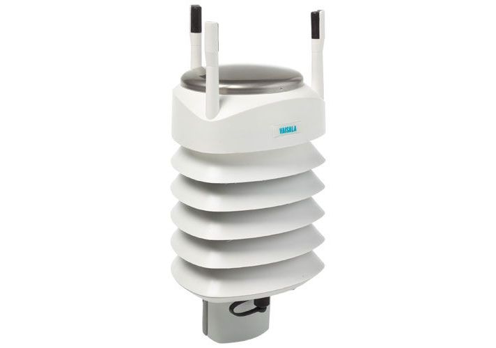
WXT533 Rainfall & Wind Sensor
- Low power consumption is ideal for battery powered systems
- No moving parts for durability and long maintenance intervals
- Easy integration with 3rd party data collection platforms
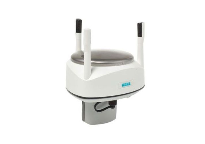
WXT536 Multi-Parameter Weather Sensor
- Low power consumption is ideal for battery powered systems
- No moving parts for durability and long maintenance intervals
- Easy integration with 3rd party data collection platforms
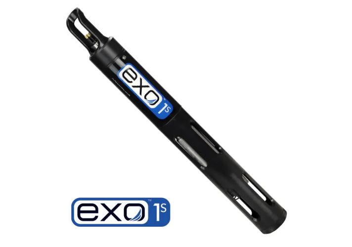
Private: EXO1s Multiparameter Sonde
- Attachment to an AUV or aerial drone
- Integration with a buoy
- Horizontal profiling where lightweight is optimal
- Highest Data Quality - Onboard monitoring systems verify sensor operation
- Multiparameter Monitoring - 4 universal ports allow for any combination of smart sensors or the central wiper
- Industry-leading Anti-fouling - Best-in-class wiper technology
- Titanium Components - The toughest grade parts guarantee operation well into the future
- Seamless Integration - EXO can plug and play into marine, estuarine, freshwater, and groundwater monitoring systems
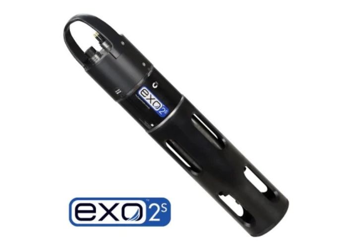
Private: EXO2s Multiparameter Sonde
- High-accuracy sensors with on-board memory
- Wireless communications
- Seamless integration into marine, estuarine, freshwater and ground water monitoring systems
- Horizontal profiling where light weight is optimal
- Smart Sondes and Sensors
- Extremely versatile instrument, allowing the user to automatically configure a sonde with different sensor for different applications in minutes
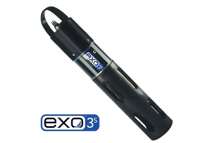
Private: EXO3s Multiparameter Sonde
- Highest Data Quality - Onboard monitoring systems verify sensor operation
- Multiparameter Monitoring - 5 universal ports allow for any combination of smart sensors or the central wiper
- Industry-leading Anti-fouling - Best-in-class wiper technology
- Titanium Components - The toughest grade parts guarantee operation well into the future
- Seamless Integration - EXO can plug and play into marine, estuarine, freshwater, and groundwater monitoring systems
Smart Sensor Options
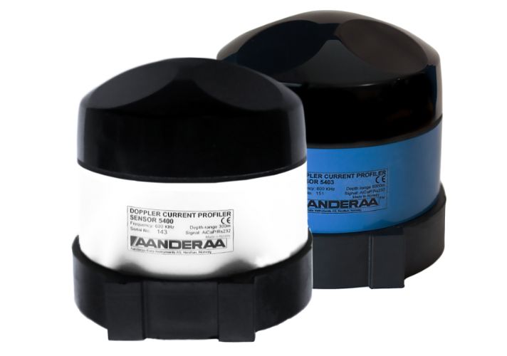
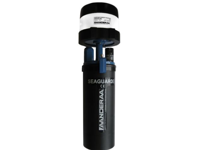
Stand-Alone Doppler Current Sensor
- Measure current direction one line.
- Measure current speed one line
- 300m, 4500m and 6000m depths
- Built-in solid state 3-axis tilt compensated compass
- Heading and tilt compensation for each ping
- Insensitive to fouling
- Low maintenance needs
- Direct readout of engineering data
- Output interval from 30 seconds to 2 hours
- RS-232/RS-422 output for integration to most third party Dataloggers
- Configurable output for easy integration
- Cell size selectable from 0,5 to 5 meters
- Up to 150 individual cells divided into three columns
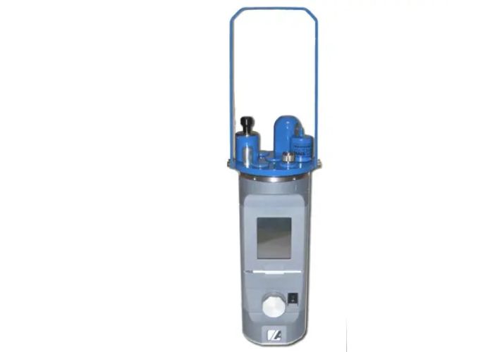
SEAGUARD® CTD Recorder
- Instrument for measuring conductivity, temperature and depth
- 300m, 2000m, 6000m depths
- Large storage capacity on SD card
- Selectable interval from 2 seconds to 2 hours
- Up to 4 Analog sensor input (0-5V)
- For use in sea and fresh water
- Low current drain
- SEAGUARD® Studio visualization software included
- Real-Time XML Output included in high power version
- Smart sensor topology based on a reliable CANbus interface (AiCaP)
- Windows CE based datalogger with color touch panel for local configuration
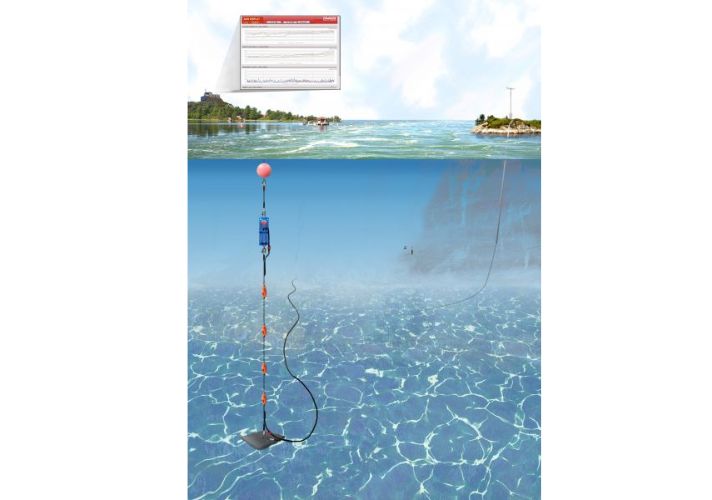
SeaGuard Sensor String
- For use in sea and fresh water
- Great flexibility; data registration from up to 25 nodes
- Customer specified outlet positions
- Protective fastening fixture with hydrodynamic design
- Plug and play sensor configuration
- Up to 4 Analog sensor inputs (0-5V) (optional)
- Up to 300m cable length
- Extended RAM for large number of nodes
- Large storage capacity on an SD card
- Real-Time XML Output RS-422 (optional)
- Short recording interval
- Each outlet position can hold 2 sensors inside
- Windows CE interface, display in color
- SEAGUARD® Studio visualization software
- 300m/3000m/6000m versions
- External power supply 12 - 30V internally regulated to 11.6V
- Optional sensors can be connected on fly leads (up to 3m) with or without underwater mateable electrical connectors
- AiCaP communication bus for automatic detection and recognition of sensors at power up
- Low maintenance
Profiling Current Meter
Applications:
- Buoy mounted
- Hyd/Met systems
- In-line mooring line with upside down possibility
- Two DCPS sensors connected to one instrument
- Ocean observatory with sensor string
- Bottom mounted
- Multiparameter ocean observations
Overview
Hydrometeorological Monitoring
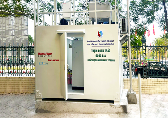
Hydrometeorological monitoring plays a pivotal role in observing, identifying, assessing, and forecasting weather and climate patterns in a specific region. This system provides essential information for predicting and warning against hazardous meteorological and hydrological phenomena that could cause damage to lives, property, and the environment. It also aids in developing timely response plans. Additionally, the system fulfills the environmental management requirements of both central and local authorities.
Hydrometeorological Observation
Hydrometeorological observation (HMObs) encompasses the collection, measurement, and recording of information related to weather, climate, seawater, and hydrological factors. HMObs is crucial for forecasting weather, floods, quantifying water resources, predicting special hydrological events such as typhoons, storm surges, and flash floods, and serves as the foundation for researching climate change and its impacts on the environment and society.
Necessity of Implementing Hydrometeorological Monitoring Systems
Apart from its role in disaster prevention and flood control, information obtained from hydrometeorological monitoring stations is also utilized for agricultural purposes, providing data for the power industry, and supporting the aviation and maritime sectors in preventing and responding to incidents during operations.
Legal Requirements
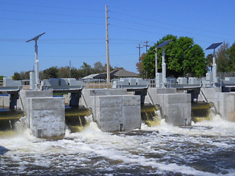
Based on the Law on Hydrometeorology and related decrees and circulars, hydrometeorological observation at construction projects and exploitation activities that are affected by or have an impact on hydrometeorological conditions is mandatory. Structures such as seaports and wharves must organize observation and provide information and data in accordance with regulations. The content, regime, and location of hydrometeorological observation for ports include measuring wind direction and speed, sea level, waves, and far visibility at sea with a frequency of 4 times a day or as per usage requirements.
Operation of Hydrometeorological Monitoring Systems
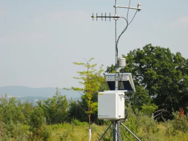
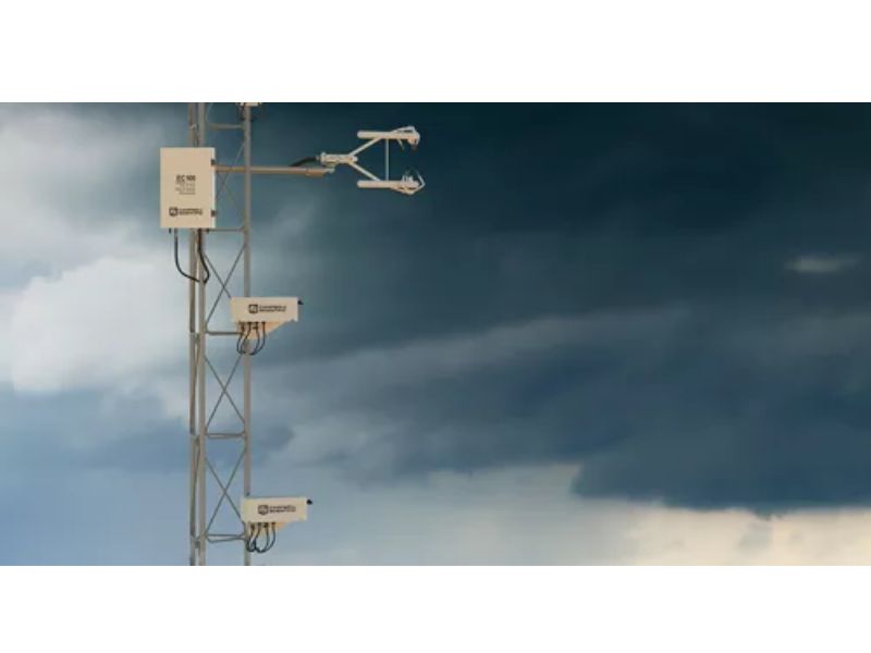
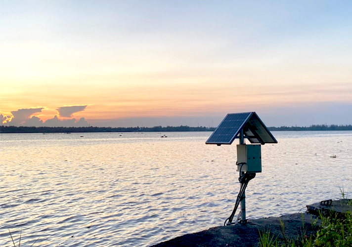
Hydrometeorological monitoring systems comprise sensors that directly interact with the atmospheric environment to measure and analyze microclimate parameters. The data is transmitted to a data logger for collection and processing, and then relayed to a control center for analysis and utilization.
Essential Components
Hydrometeorological monitoring systems encompass:
-
- Measuring devices for parameters such as wind direction and speed, temperature, air humidity, solar radiation, atmospheric pressure, rainfall, water level, water flow, suspended sediment content, wave measurement, and salinity.
- Data loggers for data collection and transmission.
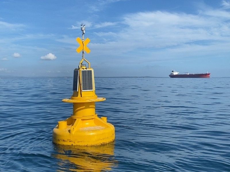
- Infrastructure and auxiliary systems (including: electrical cabinets, lightning protection devices, device installation towers/buoys).
The installation and operation of automatic hydrometeorological monitoring station systems not only fulfill legal requirements but also offer numerous practical benefits for weather management and forecasting, contributing to environmental protection and community well-being.
Required parameters
- Temperature: Measuring air and water temperatures to understand temperature variations in space and time.
- Humidity: Measuring the amount of water vapor in the air to understand the humidity and wetness of the environment.
- Air pressure: Measuring air pressure to predict weather changes and climate phenomena.
- Wind: Measuring wind direction and speed to understand wind directions and intensities.
- Precipitation: Recording precipitation to track rainfall patterns and assess flood risk.
- Water level: Measuring water levels in rivers, lakes, and other water sources to assess water resources and forecast floods.
Other parameters
- Precipitation Intensity
- UV Index
- Sun Direction
- Luminance
- Irradiance
- Aerosol Backscatter Configuration
- Cloud Base Height
- Cloud Optical Depth
- Aerosol Layer Height
- Cloud Cover
- Visibility
- Road Condition
- Pavement Temperature
- Dew Point Temperature
View more
Brochure: Maritime and Offshore Sector
Real-time data service for environmental weather and thunderstorm warnings
Real-time data service for environmental weather and thunderstorm warnings
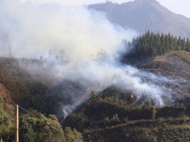
Weather Monitoring and Wildfire Alert System (RAWS)