REECO Science and Technology Co., Ltd. provides environmental and hydro-meteorological monitoring data. This data is aggregated and integrated by location and time, then processed using scientific analysis and statistical tools, combined with AI to build forecasting and warning models.
The VnEmisoft software was developed by the Reeco Tech team. The system is built on a big data platform. Data is collected from various sources such as automatic environmental monitoring stations, hydrometeorological stations, and measuring and analysis devices (which have been calibrated) shared by organizations or individuals. This data is synthesized and integrated by location and time. It is then processed using scientific analysis and statistical tools, combined with AI to build forecasting and warning models.
VnEmisoft – Automatic Monitoring Data Management Software
- VnEmisoft is a system for collecting, storing, and distributing meteorological, hydrometeorological, and environmental data developed by ReecoTech.
- VnEmisoft collects and stores data from hydrometeorological monitoring stations in real time.
- Data is connected from multiple monitoring stations, devices, dataloggers, and embedded computers via the internet, 3G/4G, satellite networks, etc.
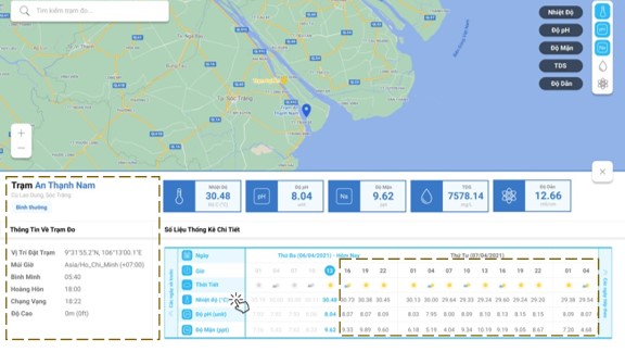
- Real-time display of measurement data on various types of tables and graphs.
- AI integration for forecasting.
- The target users are organizations, companies, government agencies, etc.
- Available for purchase or rental of hardware infrastructure such as sensors and dataloggers.
- The software operates on a web-based platform and mobile app.

Different versions of the software
|
On-Premises
|
On-Cloud |
|
|

Outstanding features of VnEmisoft software
- Dashboard monitoring: Displays real-time measurement data intuitively on the monitoring interface.
- Organization and account management: Configures permissions for each organization and individual according to their purpose of use.
- Alerting: Alerts users when parameters exceed thresholds, devices lose connection, GPS positions deviate, etc. via dashboard, email, or notification on the Mobile App.
- Export data: The system allows exporting raw data files from the software for statistical work, reports, etc.
- Visualize MAP: Displays the location of buoys, ships, and other devices with GPS positioning on the MAP Box map.
- Share dashboard: Allows multiple users to access via a URL.
- Share data: Allows data sharing with third parties and agencies such as the Department of Natural Resources and Environment (DONRE), the General Department of Meteorology and Hydrology (GDMO), or existing software of customers.
- Sync data: Allows data synchronization via http connection.
- Mobile version: The mobile version displays all tables and charts.
3 main software platforms at Reeco Tech
VnEmisoft-SPM – BSR oil spill pipeline monitoring system.
VnEmisoft-BAS – Ship berthing support system.
VnEmisoft- Lightning – Thunderstorm monitoring and warning system.
