


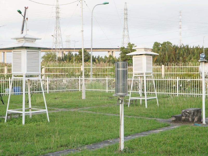
Hydrometeorological monitoring is the systematic observation and measurement of atmospheric, river, stream, canal, ditch, lake, and marine parameters with a high degree of accuracy (Clause 5, Article 3 of the 2015 Hydrometeorological Law).
-
- To ensure quality, monitoring must be accurate, continuous, and adhere to technical standards;
- Results must be representative and objectively reflect the current state of hydrometeorological phenomena in the station’s area;
- Additionally, information and data must be quality checked and evaluated.
Meteorological and hydrological information plays a crucial role in sustainable development and provides essential data for many economic and social sectors, particularly in disaster prevention, response, and recovery.
According to a 2020 report by the World Bank and the Global Facility for Disaster Reduction and Recovery, approximately 12 million people in coastal provinces are at risk of flooding, and over 35% of coastal communities face erosion. The coastal tourism industry has also been severely impacted, with 42% of beachfront hotels experiencing erosion.
Coastal residents are annually affected by natural disasters such as storms, storm surges, large waves, high tides, coastal erosion, droughts, or saltwater intrusion. Storms and storm surges are particularly hazardous to Vietnam’s coastal regions. The government has made efforts to develop a network of offshore monitoring stations to provide timely forecasts and warnings of storms and tropical depressions before they make landfall.
Coastal meteorological and hydrological stations play a vital role in monitoring weather and sea conditions, assessing climate change, weather patterns, and sea-level rise. This information helps assess tides, storm surges, and monsoon-induced fluctuations, contributing to ensuring the safety of offshore activities and minimizing disaster damage.
Thanks to efforts in meteorology and hydrology, 143 storms and tropical depressions, 348 heavy rain events, over 300 cold spells, over 170 heatwaves, and over 126 floods have been monitored and forecasted. These forecasts have helped reduce casualties and economic losses, specifically by decreasing casualties by 54% and economic losses by 78% compared to the average of the past 10 years.
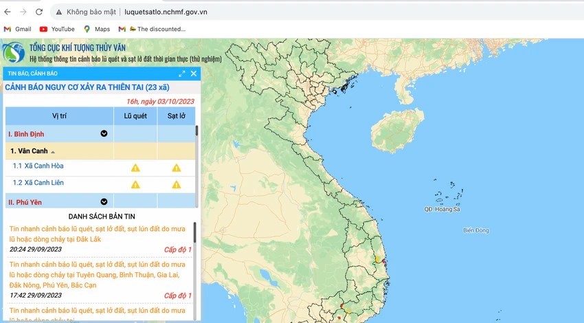
Launched in October 2023, the early warning system for rain, floods, and thunderstorms has shown initial effectiveness. Comprising three core systems, it provides quantitative rainfall analysis and forecast maps for the next six hours, leveraging weather radar and surface rainfall data. The system also integrates flash flood and landslide warnings, monitoring and tracking rainfall and flood conditions across Vietnam, and providing accurate and timely forecast information to support meteorological and hydrological warning services and community protection.