Worldwide standard for climate and boundary-layer meteorology
From single research weather stations to mesoscale weather networks (mesonets), Campbell Scientific automatic weather stations have become the worldwide standard for climate and boundary-layer meteorology. They are integral parts of forecasting and monitoring systems worldwide. Accurate measurements, low power requirements, and proven reliability in extreme weather conditions make our weather stations ideal for all types of meteorological and climatological monitoring anywhere on earth.
Product
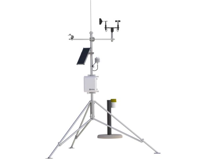
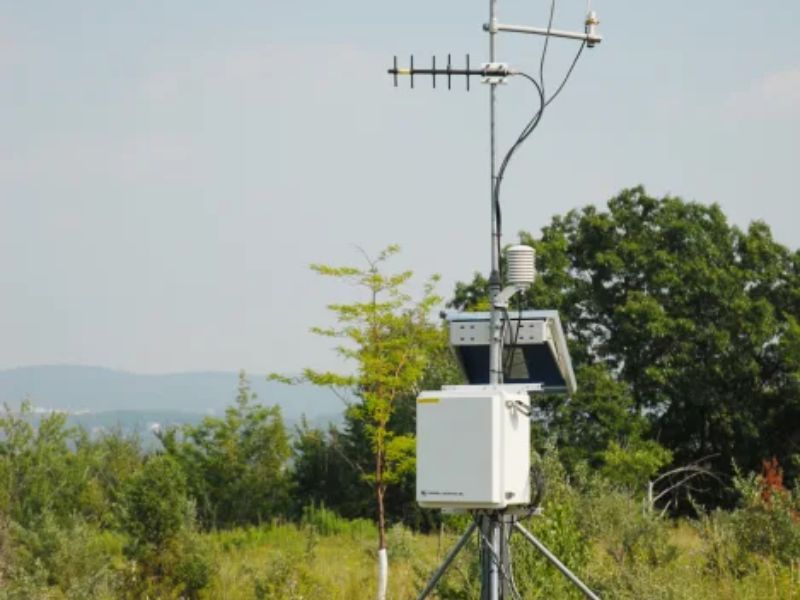
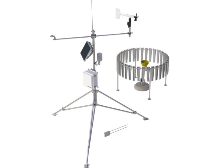
WxPRO Research – Grade Entry – Level Weather Station
The WxPRO™ is a cost-effective, research-grade weather station from Campbell Scientific, designed for diverse environmental applications. This portable station is suitable for both long-term and temporary deployments. Although it’s more affordable than the MetPRO™, it still features high-quality instruments essential for reliable environmental research. The station uses advanced sensors to measure weather phenomena, which can help calculate various weather-related metrics like evapotranspiration and wind chill.
The WxPRO can be ordered with standard parts or as a complete, preconfigured system for an additional fee. It is fully customizable, allowing the addition of specific sensors and communication devices to meet the requirements of different applications. Key measurements typically include:
-
- Wind speed
- Wind direction
- Air temperature
- Relative humidity
- Barometric pressure
- Precipitation
- Solar radiation
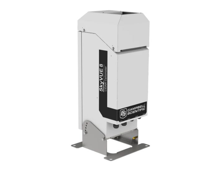
SkyVue 8 LIDAR Ceilometer
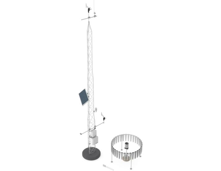
MetPRO Research-Grade Meteorological Station
-
- Wind speed
- Wind direction
- Air temperature
- Relative humidity
- Barometric pressure
- Precipitation
- Solar radiation
- Soil volumetric water content
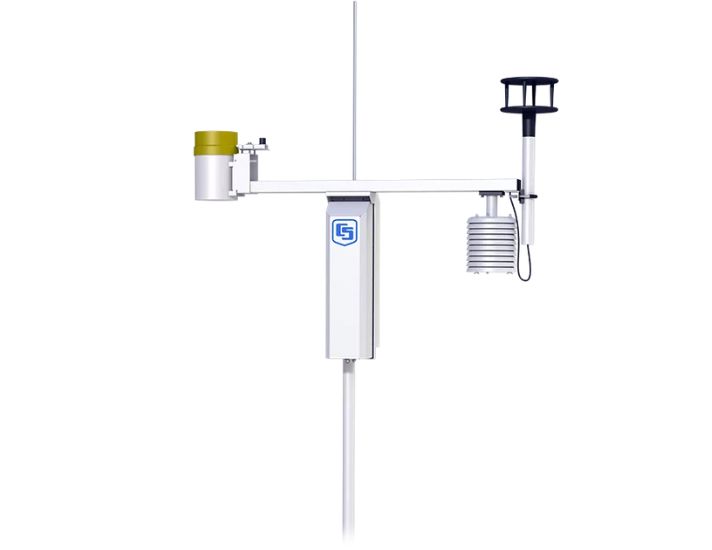
MesoPRO Research-Grade Mesonet Station
-
- Wind speed
- Wind direction
- Air temperature
- Relative humidity
- Barometric pressure
- Precipitation
- Solar radiation
- Soil volumetric water content
ET107 Evapotranspiration Monitoring Station
The ET107 is an automated weather station designed for irrigation scheduling in turf grass and commercial agriculture applications. The station calculates potential evapotranspiration (ETo), which is the amount of water lost from the soil due to evaporation and plant transpiration. Calculating evapotranspiration rate can aid in the development of an irrigation schedule that provides sufficient water without overwatering.
Overview
Data loggers for weather monitoring
Our weather stations are based around a programmable data logger (typically a CR1000 or CR3000) that measures the sensors, then processes, stores, and transmits the data. Our data loggers have wide operating temperature ranges, on-board instructions, programmable execution intervals, and ample input channels for commonly used sensors. Wind vector, wet bulb, histogram, and sample on maxima or minima are standard in the data logger instruction sets. Most sensors can be measured directly—without external signal conditioning.
Data are typically viewed and stored in the units of your choice (e.g., wind speed in mph, m/s, knots). Measurement rates and data recording intervals are independently programmable, allowing calculation of 15-minute, hourly, and daily data values from 1-minute or 1-second measurements, for example. Conditional outputs, such as rainfall intensity and wind gusts, can also be recorded. The program can be modified at any time to accommodate different sensor configurations or new data processing requirements. If needed, channel capacity can be expanded using multiplexers, including a model designed specifically for thermocouples.
Weather Sensors
Almost any meteorological sensor can be measured by our data loggers, allowing stations to be customized for each site. Typical sensors used on our stations include, but are not limited to:
-
- Wind speed and direction
- Solar radiation
- Temperature (air, water, soil)
- Relative humidity
- Precipitation
- Snow depth
- Barometric pressure
- Soil moisture
In some locations, hydrological sensors provide additional measurements, such as water level of a nearby stream.
Data Retrieval
We offer multiple communications options for data retrieval, which can be mixed within the same network. Telecommunications options include short-haul, telephone (landline, voice-synthesized, cellular), radio frequency, multidrop, and satellite. On-site options include storage module and laptop computer.
Software
Our PC-based support software simplifies the entire weather monitoring process, from programming to data retrieval to data display and analysis. Our software automatically manages data retrieval from networks or single stations. Robust error-checking ensures data integrity. We can even help you post your data to the Internet.
View more
Brochures: Custom Weather Stations
Brochures: Weather and Climate
Real-time data service for environmental weather and thunderstorm warnings