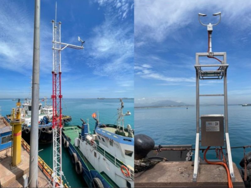
In maritime, marine environmental protection, and coastal construction industries, measuring wave height is crucial. This article will help you understand the concept of wave height, measurement methods, and its practical applications.
What is Wave Height?
Wave height is the vertical distance from the crest (the highest point of a wave) to the trough (the lowest point between two consecutive waves). It is an essential metric in oceanography, environmental engineering, and geography. Wave height helps assess the impact of the sea on the natural environment and greatly influences the design of coastal structures and maritime safety.
Wave Height Classification:
- Small waves: Less than 1 meter, commonly found in calm seas with little wind impact.
- Moderate waves: Between 1 and 3 meters, typically in offshore areas with medium wave intensity.
- Large waves: Over 3 meters, occurring during storms or rough seas, significantly affecting shipping and coastal structures.

Wave Height Measurement Parameters
Researchers use various parameters for a comprehensive and accurate understanding of wave height:
- Significant Wave Height: The average height of the highest one-third of waves over a specific time period. This is commonly used to represent wave height in an area.
- Root Mean Square Wave Height: A parameter measuring wave energy, particularly useful in wave energy studies.
- Morphological Wave Height: Represents the natural state of waves, helping assess the impact of waves on sedimentation or erosion of the seabed.
Applications of Wave Height
Understanding and measuring wave height offers several practical benefits:
- Pressure on marine structures: Wave height impacts the pressure exerted on offshore and coastal structures, helping engineers design storm-resistant structures.
- Port and vessel safety: Safe mooring depends on wave height in an area, assisting navigators in avoiding hazardous zones.
- Coastal protection and marine resource management: Wave height affects coastal sedimentation and erosion. Measurements help forecast and mitigate negative impacts on coastlines and ecosystems.
Wave Height Measurement Methods
Advanced methods provide accurate, continuous data on wave conditions:
- Wave Buoy: A floating device with accelerometers and pressure sensors to record wave height. Widely used in oceanographic research and marine management, it continuously transmits data to control centers.
- Wave Radar: Emits radar waves at the water surface, measuring the distance to the wave crest to determine wave height. Suitable for ships and offshore platforms, especially in rough seas.
- Doppler Effect (AWAC): Uses the Doppler effect to measure wave height and water current speed. The Acoustic Wave and Current Profiler (AWAC) employs sound waves to monitor waves in real time with high accuracy.
- Accelerometer-Based Wave Sensors: Mounted on floating platforms to measure wave motion acceleration, from which wave height is calculated. Useful in measuring waves on mobile devices or moving vessels
=> Read More: Meteorological and Oceanographic Observation Equipment at Reecotech
Benefits of Measuring Wave Height
Wave height measurement reduces risks and optimizes maritime operations, environmental protection, and coastal development:
- Sustainable Infrastructure Design: Wave height data enables engineers to design marine structures that withstand strong waves, extending the life of structures.
- Maritime Safety: Wave height information allows vessels to avoid dangerous seas and plan safe routes during storm seasons.
- Coastal Erosion Prevention: Measuring wave height aids in predicting and preventing adverse effects on coastlines, protecting sensitive ecosystems.
Reecotech’s Oceanographic Observation Solutions
Reecotech is a leading provider of environmental, meteorological, and hydrographic observation solutions in Vietnam. The company supplies equipment for port management and environmental analysis in observatories and labs. One of Reecotech’s key solutions is the Meteorological and Oceanographic Monitoring Buoy Station, measuring parameters like:
- Meteorology: Wind speed and direction, air temperature, humidity, atmospheric pressure.
- Oceanography: Currents, waves (height, period, direction).
- Water Quality Indicators: Temperature, conductivity, salinity, turbidity, dissolved oxygen, total algae, cyanobacteria, fDOM/CDOM, total dissolved solids.
Reecotech also offers RangeFinder wave and water level radars, allowing for rapid and precise wave speed and tide measurement.
Wave height measurement is vital in scientific research, environmental protection, and sustainable infrastructure development. If you are interested in wave observation equipment and solutions, contact Reecotech for detailed consultation at hotline 0938 696 131.


